
Service Descriptions
Prairie Hawk Aerial Recon delivers premium, mission-ready aerial services built on precision, discretion, and results. Using advanced drone, thermal, and mapping technology, we provide clear, actionable intelligence—not just footage—whether for land management, wildlife recovery, real estate, or construction documentation. Every mission is flown safely, ethically, and professionally, with an uncompromising focus on accuracy, reliability, and high-quality deliverables you can trust.
🦌 Deer Census (Thermal Aerial Survey)
Starting at $500
What it is
A structured, thermal-based aerial survey designed to estimate deer presence, distribution, and herd composition across your property.
Who it’s for
Landowners, hunters, and property managers who want data-backed insight—not guesswork—before making harvest or habitat decisions.
What you receive
PDF Executive Summary (clear, client-friendly)
Annotated property map with deer observations
Select thermal still images
Herd metrics and management recommendations
Why it matters
Thermal surveys provide a snapshot of deer activity that trail cameras alone can’t. The result is better planning, smarter harvest decisions, and improved land stewardship.
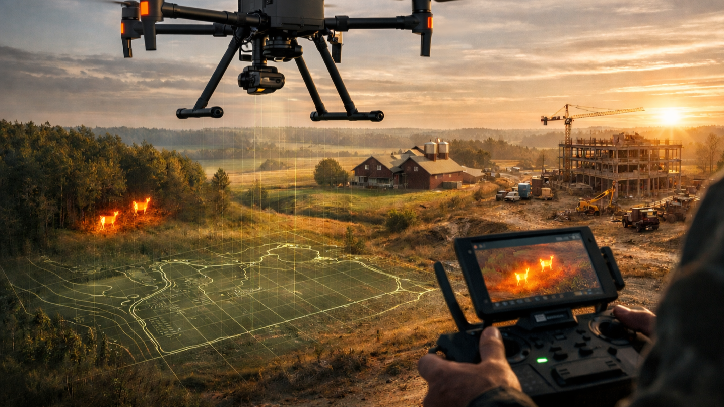
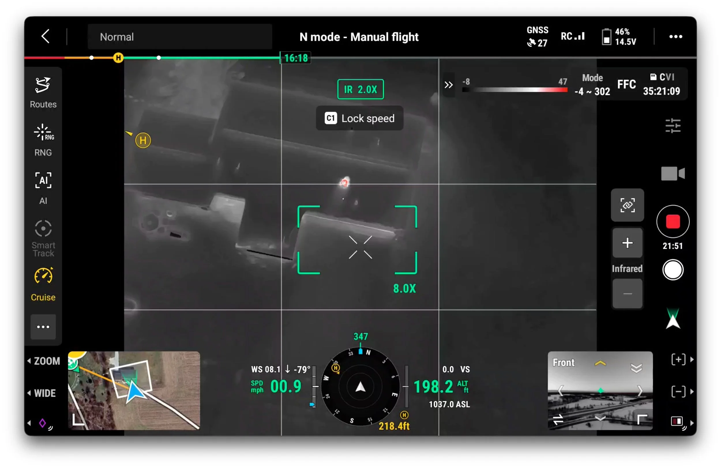
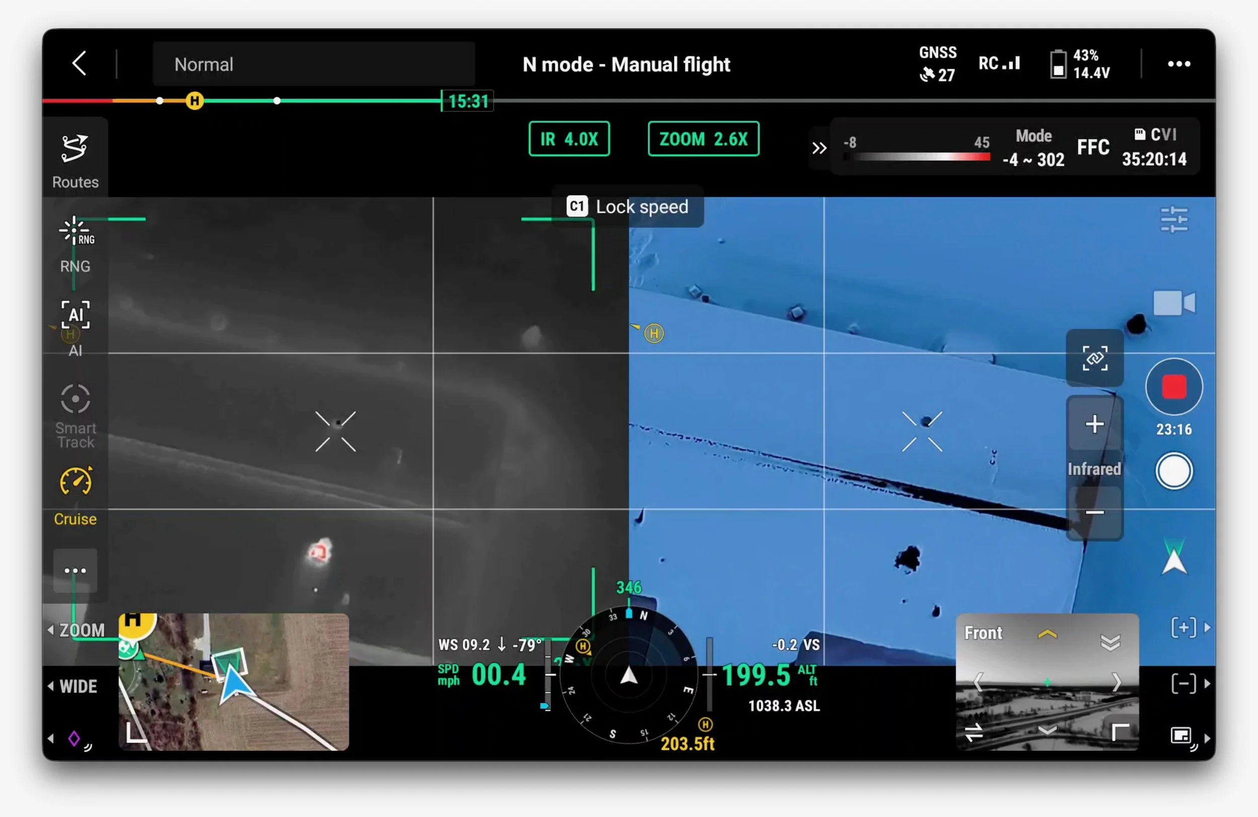
🦌 Deer Recovery (Thermal-Assisted)
Starting at $400
What it is
Thermal-assisted aerial search to help locate wounded or downed deer quickly and ethically.
Who it’s for
Hunters who want to maximize recovery success while minimizing unnecessary tracking pressure.
What’s included
Rapid-response thermal search
Structured search grid based on last-known information
GPS location of recovered animal
On-site guidance to recovery location
Notes
Time-sensitive service — earlier response improves success
Conducted with discretion and respect for land and wildlife

🐾 Pet Recovery (Thermal-Assisted)
Starting at $500
What it is
Thermal-assisted aerial search to locate lost pets, especially during low-light or cold conditions when heat signatures are strongest.
Who it’s for
Pet owners who need speed, coverage, and calm coordination during a stressful situation.
What’s included
Thermal search grid tailored to terrain and conditions
Analysis of last-known location and movement patterns
Live guidance during active recovery window
Priority response when available
Notes
Best results occur within the first 24–48 hours
Operated with privacy and neighborhood discretion
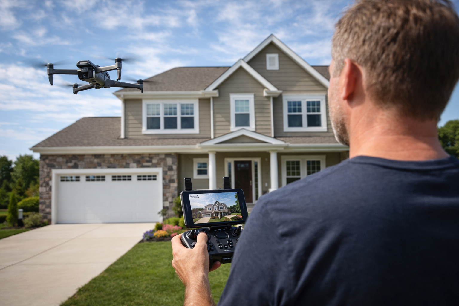
🏠 Real Estate Aerial Media
Starting at $400
What it is
Professional aerial photos and video that elevate property listings and highlight land, access, and surroundings.
Who it’s for
Real estate agents, brokers, and property owners who want polished visuals that stand out.
What you receive
MLS-ready aerial photos
Cinematic aerial video clips
Optional interior/exterior combined packages
Fast turnaround (typically 24–48 hours)
Why it works
Aerial context sells property. Clean, legal, insured drone work builds confidence with buyers and agents alike.
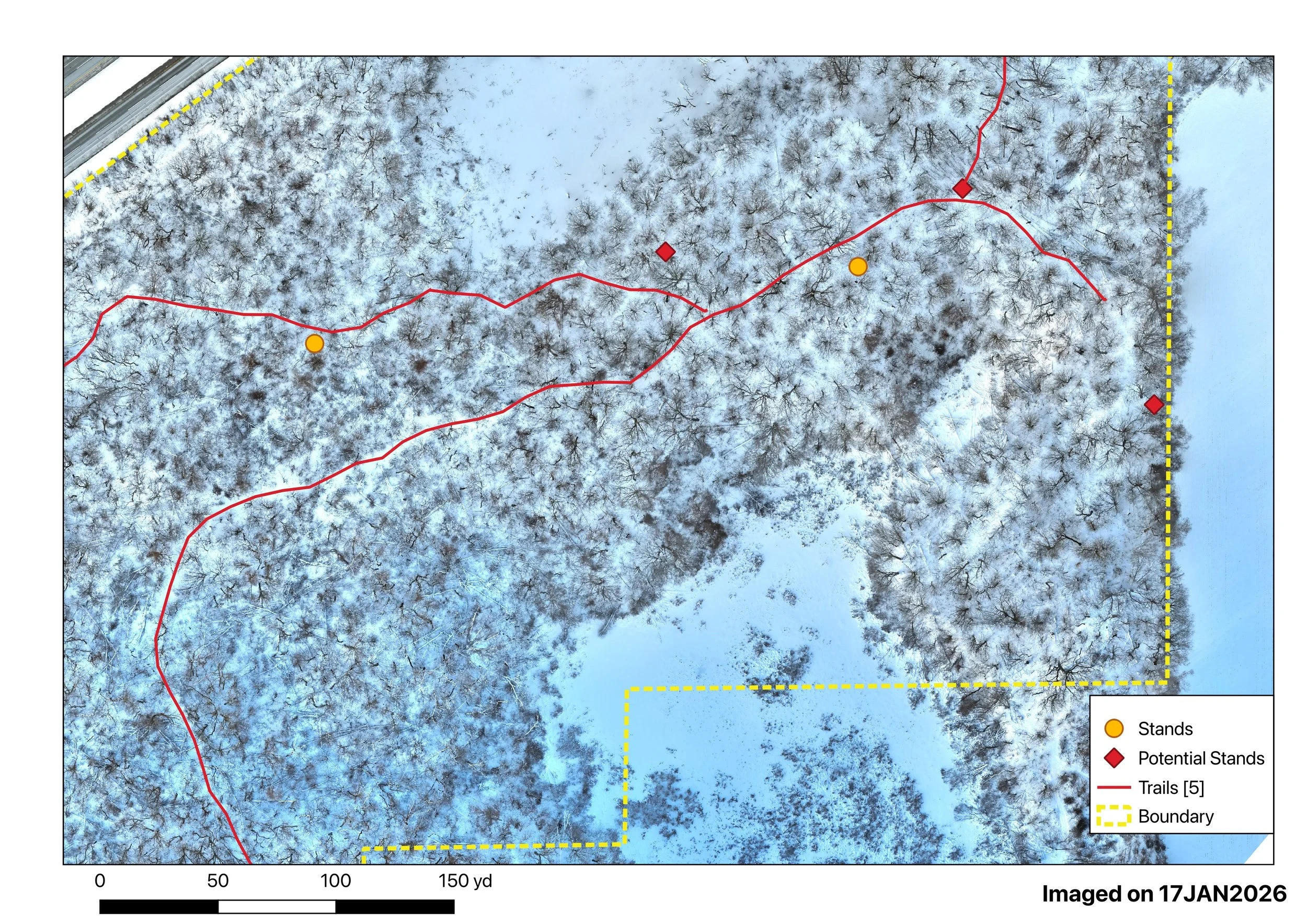
🗺️ Mapping & Measurement (Land, Forest & Agriculture)
Starting at $25 per acre (minimums apply)
What it is
High-resolution aerial mapping and modeling designed to support land management, forestry, agriculture, and construction using structured flight planning and professional processing workflows.
Who it’s for
Landowners, foresters, farmers, and contractors who need accurate, measurable, decision-ready data—not just aerial images.
Use Cases
🌲 Forest & Land Management
Property boundary visualization
Timber stand overview and planning
Access road and trail mapping
Habitat layout and improvement planning
Change detection over time
🌾 Agriculture
Field and crop area mapping
Drainage and water flow visualization
Field access and infrastructure planning
Seasonal documentation and comparison
Support for agronomic planning (visual, not advisory)
🏗️ Construction & Planning
Site documentation and progress tracking
Earthwork and layout visualization
Measurement-ready maps and models
Communication with stakeholders and crews
What You Receive
High-resolution orthomosaic (2D map)
Optional 3D models for terrain and visualization
Measurement-ready outputs (distance, area, volume*)
WebODM-based professional processing
Clear deliverables suitable for planning and reporting
*Volume measurements available where conditions allow.
Why It Matters
Accurate maps reduce guesswork. Whether you’re planning timber work, managing fields, or tracking site changes, aerial mapping provides context, scale, and measurable insight that ground-based observation alone can’t deliver.

🎥 Marketing & Event Aerial Coverage
Starting at $600
What it is
Professional aerial video and photography designed to capture attention, elevate your brand, and tell a story from above. Ideal for marketing campaigns, community events, property showcases, and promotional content.
Who it’s for
Businesses, organizations, event planners, and property owners who want high-impact visuals that stand out across websites, social media, and presentations.
What you receive
Cinematic aerial video clips (4K)
High-resolution aerial still images
Professionally edited, brand-ready content
Files optimized for web, social, and presentation use
Common use cases
Business and brand marketing
Community and outdoor events
Property and land showcases
Promotional and social media content
Highlight reels and teasers
Why it works
Aerial visuals add scale, context, and energy that ground-based cameras can’t match. Prairie Hawk focuses on clean composition, smooth motion, and intentional storytelling—not gimmicks.
Pricing notes
Pricing based on event duration, location, and deliverables
Editing and multiple output formats available
Fully insured and FAA-compliant operations
Fast turnaround options available
🏠 Aerial Home & Roof Inspections
Starting at $350
What it is
A non-invasive aerial inspection service that provides clear visual documentation of roofs and exterior structures using high-resolution drone imagery.
Who it’s for
Homeowners, property managers, and real estate professionals who need safe, efficient documentation without ladders or scaffolding.
What you receive
High-resolution aerial images of roof and exterior areas
Optional annotated images highlighting observed conditions
Organized digital delivery for easy review or sharing
Documentation suitable for maintenance planning or contractor review
Common use cases
Roof condition documentation
Storm or weather-related visual assessments
Pre-sale or pre-purchase documentation
Property maintenance planning
Hard-to-access or multi-story structures
Important note
Prairie Hawk provides visual inspection and documentation only. We do not provide engineering evaluations, code compliance determinations, or insurance claim approvals.
Why it matters
Aerial inspections reduce risk, save time, and provide a clear visual record. You get eyes on the roof without unnecessary exposure or disruption.
Pricing notes
Pricing based on structure size, complexity, and location
Same-day or next-day delivery available
Fully insured and FAA-compliant operations
Client retains full ownership of all imagery
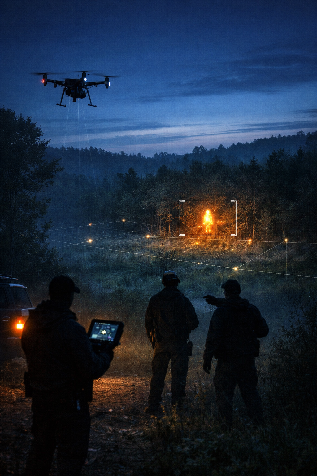
Public Safety
Search & Rescue Support
Contracted Services Only
Available to authorized agencies
Pricing and scope provided via SAR capability statement