
Book Your 2026 Deer Census Flights Now!
We limit the number of deer census clients each year to ensure the very best service.
Make sure you secure a pre-season herd analysis flight before all the slots are gone!
Intelligence. Not just Imagery.
Precision Aerial Intelligence for Wildlife, Land, Property, and Construction
FAA Part 107 Certified | Fully Insured | Serving Northwest Indiana
Advanced drone, thermal, and mapping services for landowners, hunters , and professionals.
For deer and pet recovery, call/text between 6am and 10pm Central all days of the week for same day response.
For all other inquiries, call between 8am and 6pm Central, Monday - Friday, or email/text any time. We will respond within 24hrs.
Veteran-Owned & Operated
Tactical Recon & Analytics Experience
Privacy-First Operations
See what we’ve been up to on YouTube, Facebook and Instagram!
Military grade service and deliverables.
Prairie Hawk Aerial Recon provides mission-focused aerial intelligence using advanced drone, thermal, and mapping technology.
We support wildlife management, recovery operations, property marketing, and land and construction documentation with precise, decision-ready deliverables — not guesswork or generic video.
Based in Northwest Indiana, we operate with a military-grade mindset: safety first, discretion always, and results that matter.
Core Services
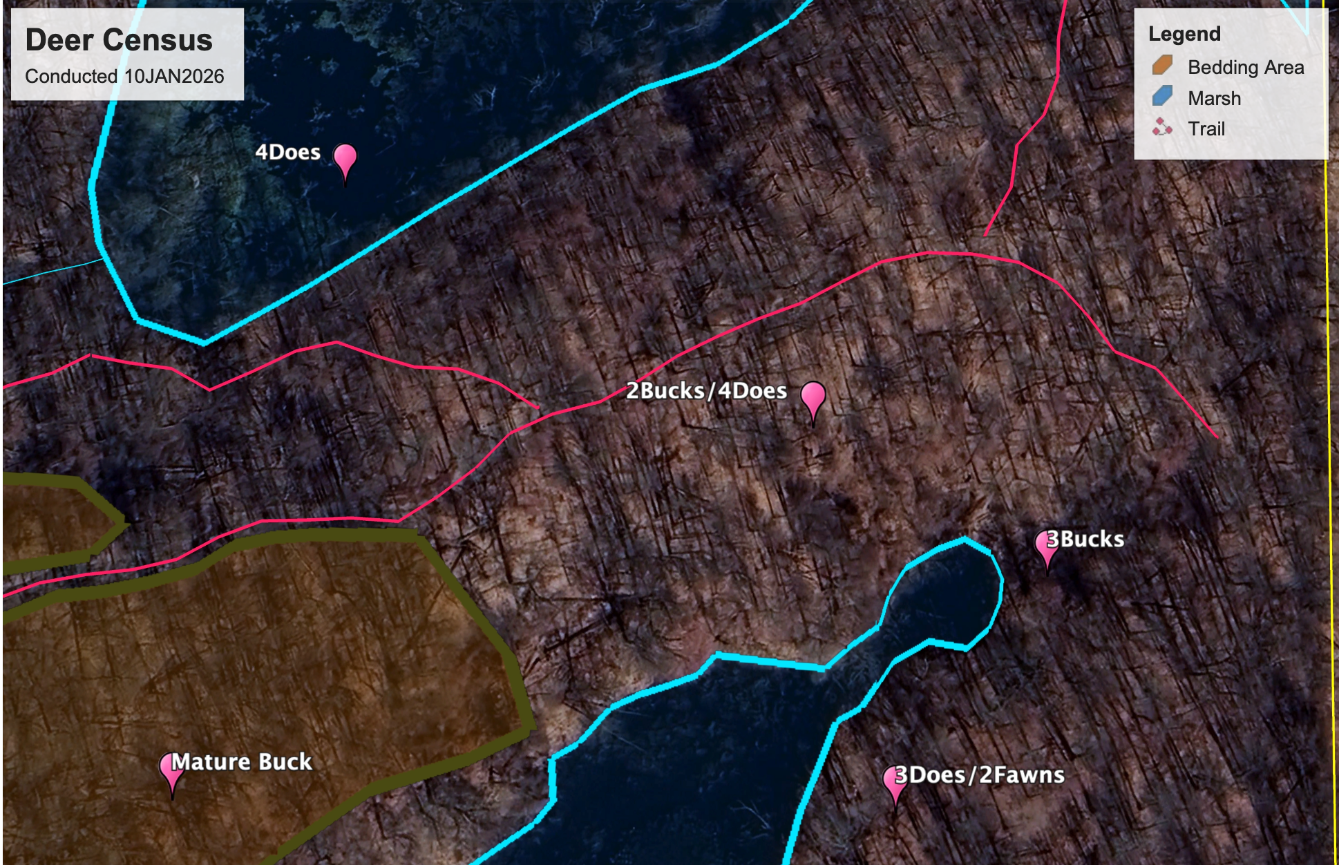
🦌 Deer Census
Make informed harvest and habitat decisions with defensible data.
Includes:
PDF Executive Summary
Annotated Property Map
Select Thermal Stills
Herd Metrics & Recommendations
Starting at $500
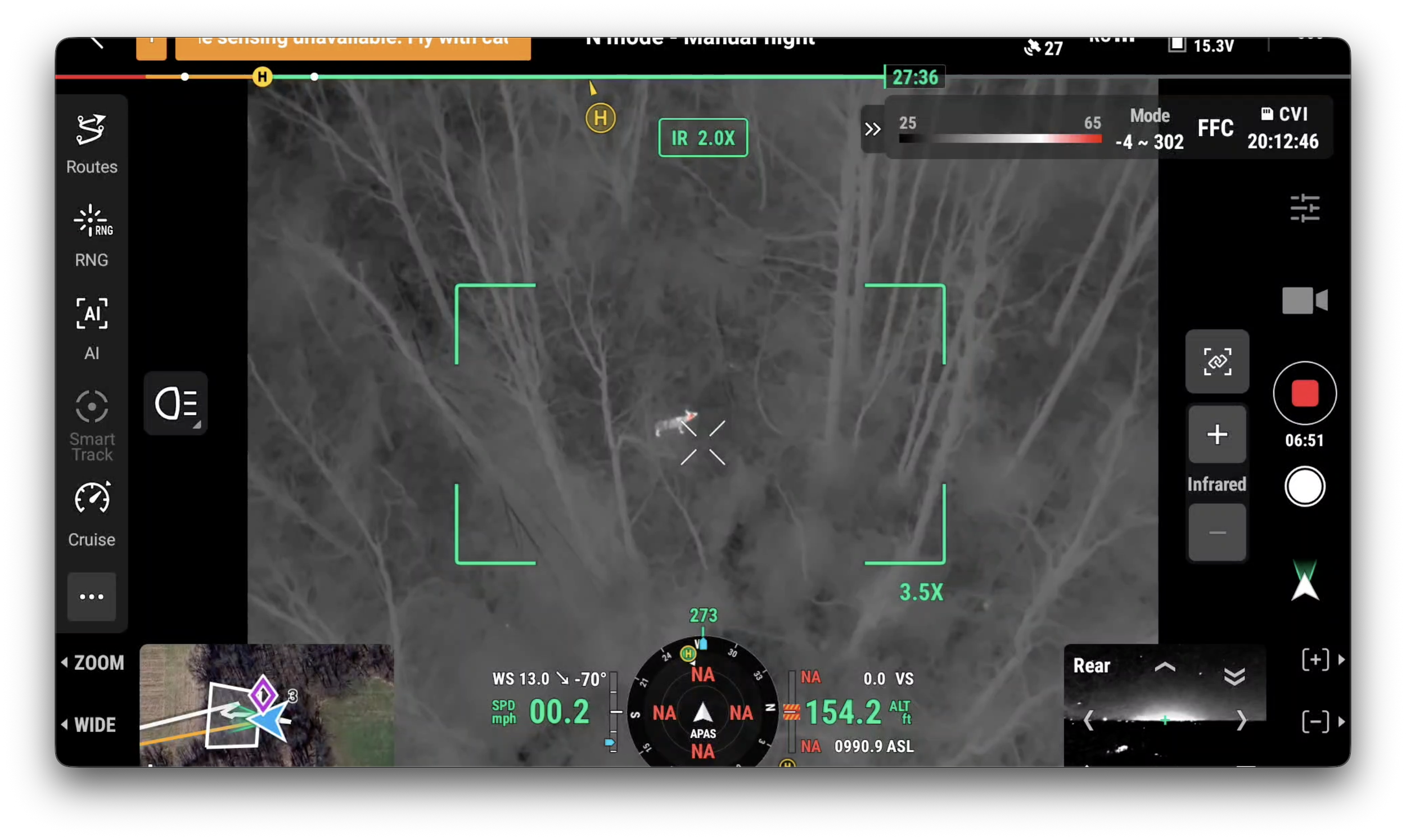
🦌 Deer Recovery
Ethical, fast recovery using thermal-assisted search.
Includes:
Rapid response thermal search
GPS recovery location
On-site guidance to animal
Starting at $400

🐾 Pet Recovery
Thermal-assisted recovery when time matters most.
Includes:
Structured thermal search grid
Last-known-location analysis
Live guidance during recovery window
Rapid response emphasis
Starting at $500
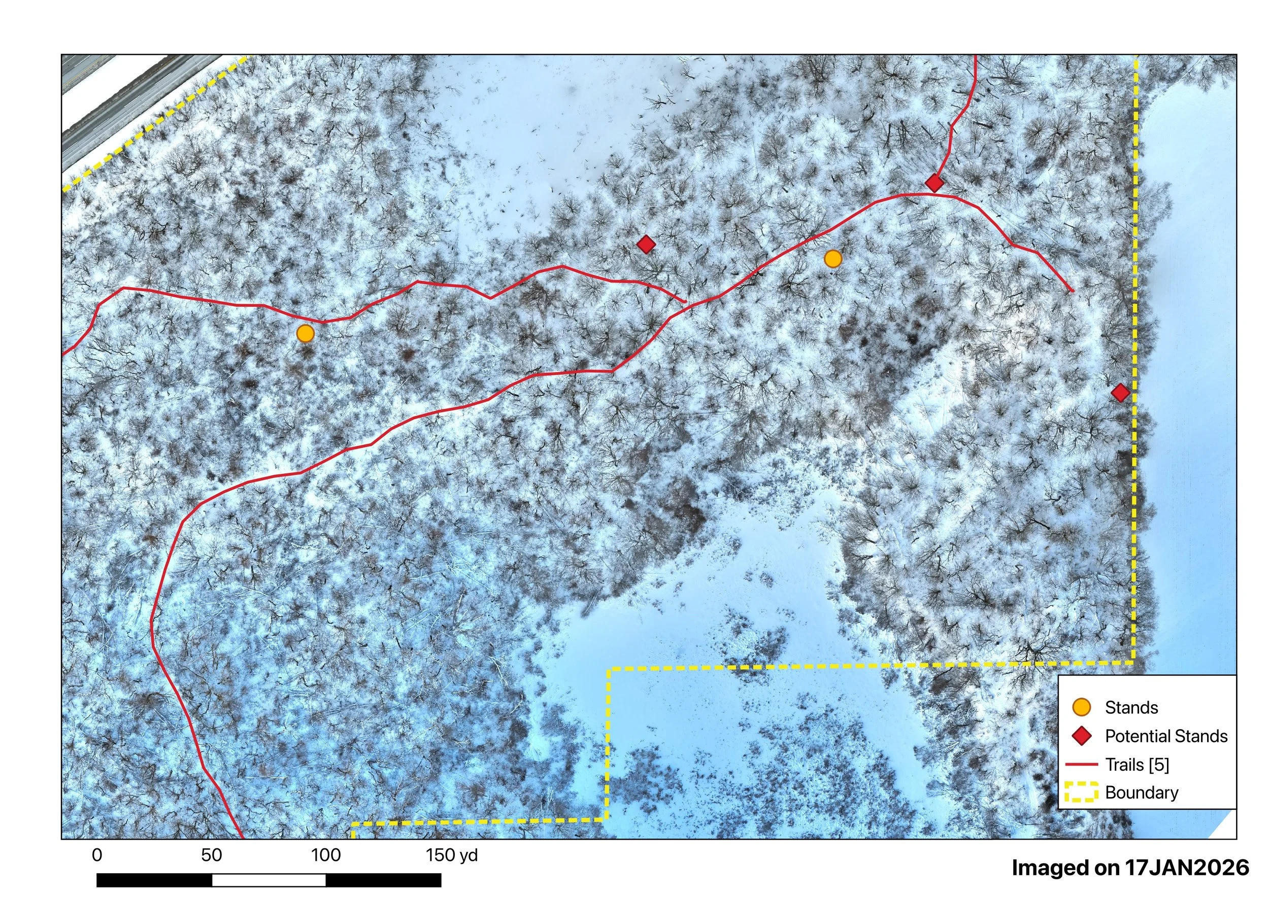
🗺️ Mapping & Measurement
Accurate models you can measure and trust.
Includes:
High Resolution Orthomosaics (2D)
3D models and site visualization
Measurement-ready outputs
Ideal for land, construction, and agriculture planning
Starting at $25 / Acre (minimums apply)
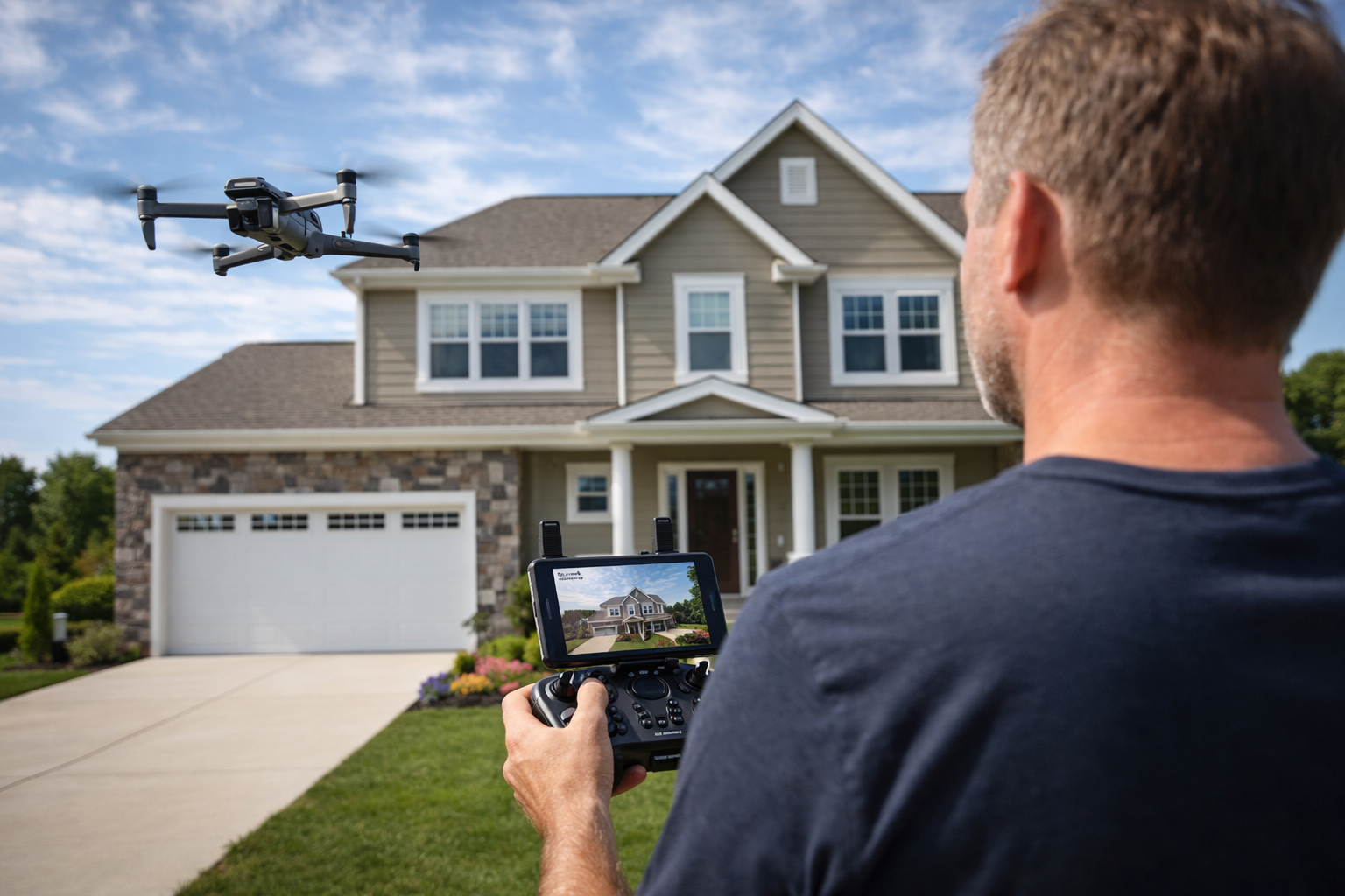
🏠 Real Estate Aerial Media
Professional visuals that elevate listings.
Includes:
Aerial photos (MLS-ready)
Cinematic aerial video
Optional interior/exterior combo
24–48 hr turnaround
Starting at $400
Transparent, upfront pricing. No surprises.
View starting prices, package options, and service details before you book.
EXPERIENCE & CREDIBILITY
Prairie Hawk Aerial Recon is led by a retired Naval Aviator with experience in tactical reconnaissance, analytics, and decision support across military and government operations.
That background translates directly into:
Structured data collection
Analytical reporting (not just imagery)
Safety-first flight operations
Clear, actionable deliverables
This isn’t hobby drone work — it’s mission-driven aerial intelligence applied to land, wildlife, and property.

Prairie Hawk owner flying above USS Kitty Hawk circa 2005
PRIVACY & DATA HANDLING
Your data is your data.
Clients retain full ownership of all imagery and deliverables
No resale or reuse without explicit permission
Secure handling and limited retention
Wildlife- and privacy-respecting operations at all times
Discretion and ethics are not optional — they are standard.
PORTFOLIO PREVIEW
See examples of:
Thermal wildlife imagery
Deer census maps & reports
Aerial property visuals
Mapping and measurement outputs
Contact Us
Have land, wildlife, or property questions that require real answers?
Let Prairie Hawk put eyes on it!